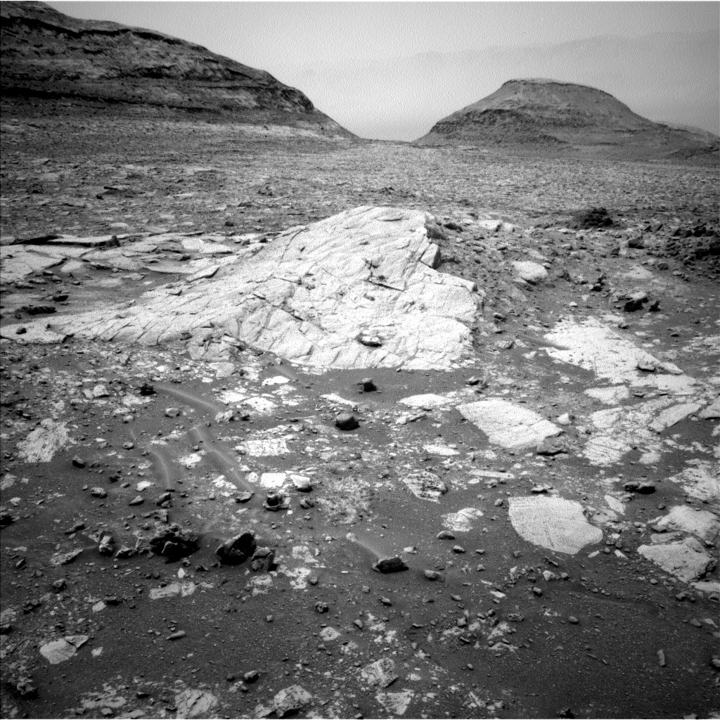
West Side of Upper Gediz Vallis, From Tungsten Hills to the Next Rocky Waypoint - Curiosity Rover Blog for Sols 4302-4303
Earth planning date: Wednesday, Sept. 11, 2024
The rover is on its way from the Tungsten Hills site to the next priority site for Gediz Vallis channel exploration, in which we plan to get in close enough for arm science to one of the numerous large dark-toned “float” blocks in the channel and also to one of the light-toned slabs. We have seen some dark blocks in the channel that seem to be related to the Stimson formation material that the rover encountered earlier in the mission, but some seem like they could be something different. We don’t think any of them originated in the channel so they have to come from somewhere higher up that the rover hasn’t been, and we’re interested in how they were transported down into the channel.
We aren’t there yet, but the 4302-4303 plan’s activities include some important longer-range characterization of the dark-toned and light-toned materials via imaging. Context for the future close-up science on the dark-toned blocks will be provided by the Mastcam mosaics named “Bakeoven Meadow” and “Balloon Dome.” The broad Balloon Dome mosaic also covers a low dome-like structure formed by the light-toned slab-like rocks (pictured). Smaller mosaics will cover a pair of targets that include contacts where other types of light-toned and dark-toned material occur next to each other in the same block: “Rattlesnake Creek” which appears to be in place, and “Casa Diablo Hot Springs,” which is a float.
The rover’s arm workspace provided an opportunity for present-day aeolian science on the sandy-looking ripple, Sandy Meadow. Mastcam stereo imaging will document the shape of the ripple, while a suite of high-resolution MAHLI images will tell us something about the particle size of the grains in it. The modern environment will also be monitored via a suprahorizon observation, a dust devil survey, and imaging of the rover deck to look for dust movement.
The workspace included small examples of the dark float blocks, so the composition of one of them will be measured by both APXS and ChemCam LIBS as targets “Lucy’s Foot Pass” and “Colt Lake” respectively.
In the meantime, the Mastcam Boneyard Meadow mosaic will provide a look back at the Tungsten Hills dark rippled block along its bedding plane to try to narrow down the origin of the ripples and the potential roles of water vs. wind in their formation.
Communication remains a challenge for the rover in this location. During planning, the rover’s drive was shifted from the second sol to the first sol in order to increase the downlink data volume available for the post-drive imaging, thereby enabling better planning at the science waypoint we expect to reach in the weekend plan. However, maintaining communications will require the rover to end its drive in a narrow range of orientations, which could make approaching our next science target a bit tricky. We’ll find out on Friday!
Written by: Lucy Lim, Planetary Scientist at NASA Goddard Space Flight Center Edited by: Abigail Fraeman, Planetary Geologist at NASA-JPL
Source for this blog and the archive of all blogs (with all the links and the original raw images etc): https://science.nasa.gov/blog/sols-4302-4303-west-side-of-upper-gediz-vallis-from-tungsten-hills-to-the-next-rocky-waypoint/
These blog updates are provided by self-selected Mars Science Laboratory mission team members who love to share what Curiosity is doing with the public.
Dates of planned rover activities described in these reports are subject to change due to a variety of factors related to the Martian environment, communication relays and rover status.
Image credits: NASA/JPL-Caltech


I would hope they do a mix of “old world” and ‘new’ world names 😁
The dump is a text file i’ve updated as the mission progressed. Saves me time when I get asked the question re place names.