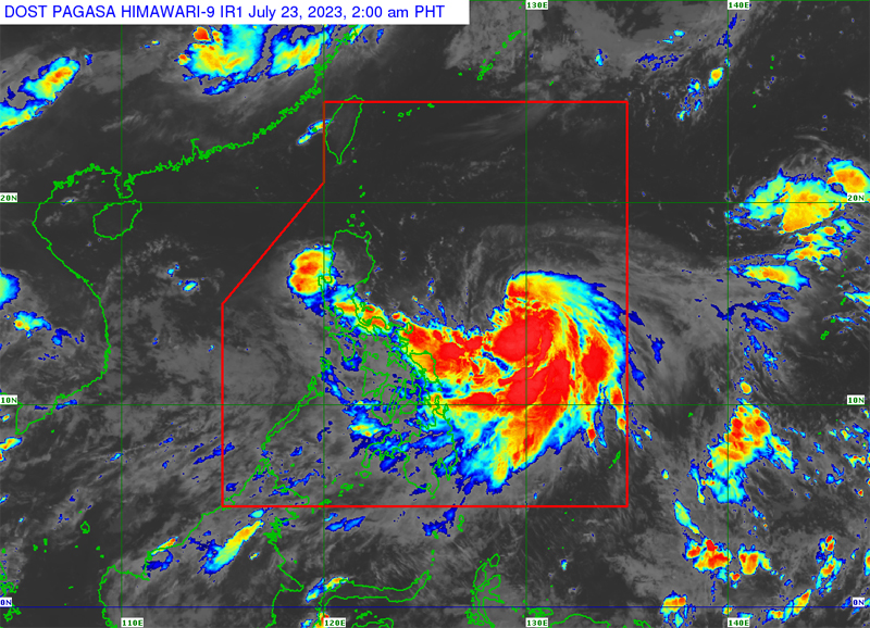
Watching this vid to help me catch up with this news, but one thing that kept bugging me is “Sayang, di sumakto sa SONA.”
On a more serious note, ingat sa mga taga-northern Cagayan! Not only is this typhoon “erratic” (in the sense that different forecasting models don’t seem to agree that much), one of the models also predict some wind movement that is pretty concerning:

The typhoon winds might align such that it’d blow southwards towards the Cagayan river, causing it to back up and cause flooding. Fingers crossed that it won’t be the case, but still…
Over here in QC, the rain is starting to pour non-stop na. Could see this continuing until the next day.
I feel bad for those living in the flood-prone areas of northern Metro Manila (special mention sa Tumana and Tullahan riverside areas), but on the other hand, we need the rain to fill up our dams for the incoming El Niño.
Here where I live, I hear thunder every now and then, but not much rain. I do live “in the south” though.
The forecasted path of the eye of the storm has gone lower and lower the closer it gets, looking at zoom earth.
Yeah, I just hope that the change in the wind direction (as the storm is closer to land) would lessen the danger of the river backing up and that dreaded storm surge. Not that the storm being closer to land is any good either.
EDIT:
I double-checked with earth-nullschool, the predicted position at 2023 July 25, 00:00 (UTC; 08:00AM PST) is still similar to the one I had in the screenshot in my previous reply:
https://classic.nullschool.net/#2023/07/25/0000Z/wind/surface/level/orthographic=-225.27,17.72,1873


