The most frustrating thing about this is everyone in this thread is complaining about how Republicans are too stupid to understand why the map is colored the way it is…while being absolutely fooled as to why the other map is the way it is.
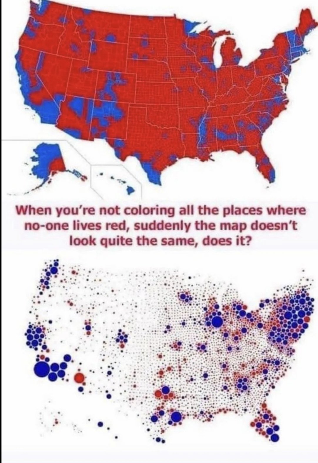
Fwiw I don’t think anyone’s “fooled” by the first map. Or (again, imo) that all republiQans are too stupid to understand why sand doesn’t vote.
I do think the first map is regularly used as a right-wing talking point by individuals and corporate news to “explain” how republiQans must be winning elections, and that explanation is false. Presumably many of the individuals and all corporate news organizations know that. Which is why it’s just straight-up propaganda.
My point is that the second map, at least the way it is being framed in this meme, is equally misleading.
What it is presumably showing is dot in the middle of each county (although clearly not in middle for places like the NE that are being pushed apart, but I think it’s true for like kansas/nebraska) that is scaled relative to the population of that county. It’s not necessarily where the people in that county live.
I get that Republicans use the former map to deceive and spread propaganda. What I’m pointing out is that is exactly what is happening with the way the second map is being framed in this meme. It’s pure absurdity for people to fall hook, line, and sinker for it. . .while shitting on the intelligence of people who fell hook, line, and sinker for another map being presented in a misleading way.
Oh right - well, again fwiw, I doubt people are lead to believe that midwest populations are laid out in perfect order like that.
Hm. That said, most midwest towns are laid out in some kind of grid. But that’s more about transportation than politics.
Both the title of the submission and the wording on the graph indicates otherwise.