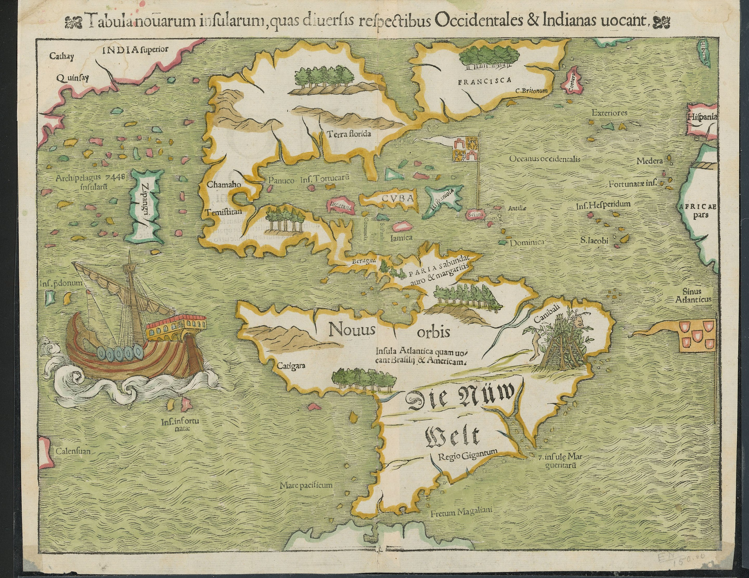
Flying Squid to Today I LearnedEnglish • 5 months agoTIL about Sebastian Münster's 1540 map of the Americas, the first one to show that North and South America were connected by an isthmus and the first to call it 'The New World.'imagemessage-square58arrow-up1361arrow-down15file-textcross-posted to: [email protected]
arrow-up1356arrow-down1imageTIL about Sebastian Münster's 1540 map of the Americas, the first one to show that North and South America were connected by an isthmus and the first to call it 'The New World.'Flying Squid to Today I LearnedEnglish • 5 months agomessage-square58file-textcross-posted to: [email protected]
minus-squareHubertMannelinkfedilink1•5 months agoum. because its not far off but the replies I got explained the problems they had longitude and how it got better.
minus-square@NiHaDuncanlinkEnglish1•5 months agoNorth/south would be latitude, so they could easily and accurately position them correctly with respect to that aspect.
minus-squareHubertMannelinkfedilink1•5 months agoNow im a bit confused about the replies I got. That would explain why the shapes are so wierd. I was thinking it was because they only new the coasts


Why “wow”…?
um. because its not far off but the replies I got explained the problems they had longitude and how it got better.
North/south would be latitude, so they could easily and accurately position them correctly with respect to that aspect.
Now im a bit confused about the replies I got. That would explain why the shapes are so wierd. I was thinking it was because they only new the coasts