

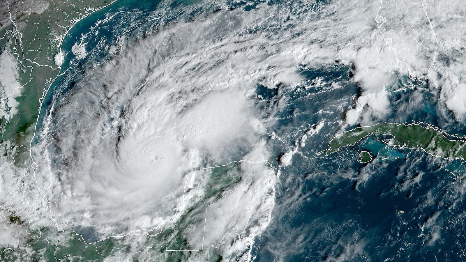
Milton rapidly intensified to a Category 5 hurricane late Monday morning.
Within hours, Milton strengthened to a Category 2, then a Category 3, then a Category 4 and finally a Category 5.
Milton now ranks as the third-greatest 24-hour wind speed intensification for a hurricane in the Atlantic Basin. (Records are based on data since the satellite era began in the 1960s.)
Minimal. Helene went north, and really only hit the pan handle area, Milton is going East and is going to pass through the middle of Florida.
Even though it was like 100 miles off shore, the Tampa Bay area had an 8 foot storm surge with Helene that killed 12 people and ruined tens of thousands of homes and businesses. There are piles of debris everywhere along the coast that are going to become projectiles in hurricane force winds of they can’t be picked up in time. Almost the entire western coast of Florida saw significant impact from Helene
That’s still probably better than if there was debris from a direct hit.
Well yes, two direct hits would be worse. Was just saying Helene had a pretty severe impact on the areas that are going to be hit directly this time
At least mid Florida is mostly higher elevation for dealing with the storm surge. The winds will be brutal.
One of the things I’m wondering about is whether Helene chopped up the water and caused some overturning/cooling that may lower surface temps.
And if it did (or did so to a meaningful degree), is that helping to temper Milton before it makes landfall?
And I guess I’m commenting here because you seemed so confident. (Maybe you’re just making it up as you go along, too. Who knows?!)
That’s probably why everyone is super split on the landfall category of the hurricane.
That should play an impact and overcast and heavy rain should make for a less welcoming Florida.
However we have seen that shallower waters by the coast have been very very hot lately and do a lot to bump up hurricanes as they near the shallows and it could intensify the storm again as it nears land.
Tampa doesn’t get hit directly by storms and they don’t generally form to category 5 hurricanes in about 12 hours in the gulf of Mexico so there is a lot of new science and prediction work to be done here so it’s a lot of guessing till it does.