
After seeing something similar elsewhere I decided to give this a go.
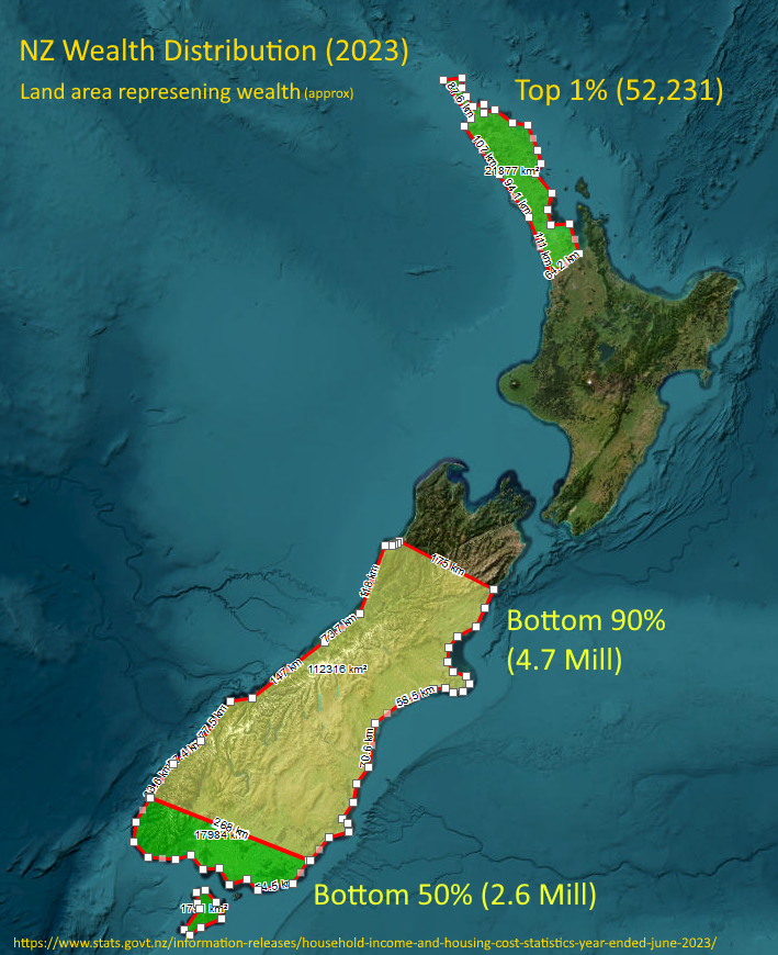
Honestly, I thought the top 1% (population the size of Hastings) might reach down to Whangarei or at most upper-upper Auckland, but it’s the visual representation of the top 10% - basically everything north of about Kaikoura - that shocked me the most!
Very interesting take, OP. Can you please elaborate why you think this is the situation for NZ?
https://en.m.wikipedia.org/wiki/North_Island
76% of NZ’s population are on the north island, so I’m not entirely sure how those numbers are supposed to work.