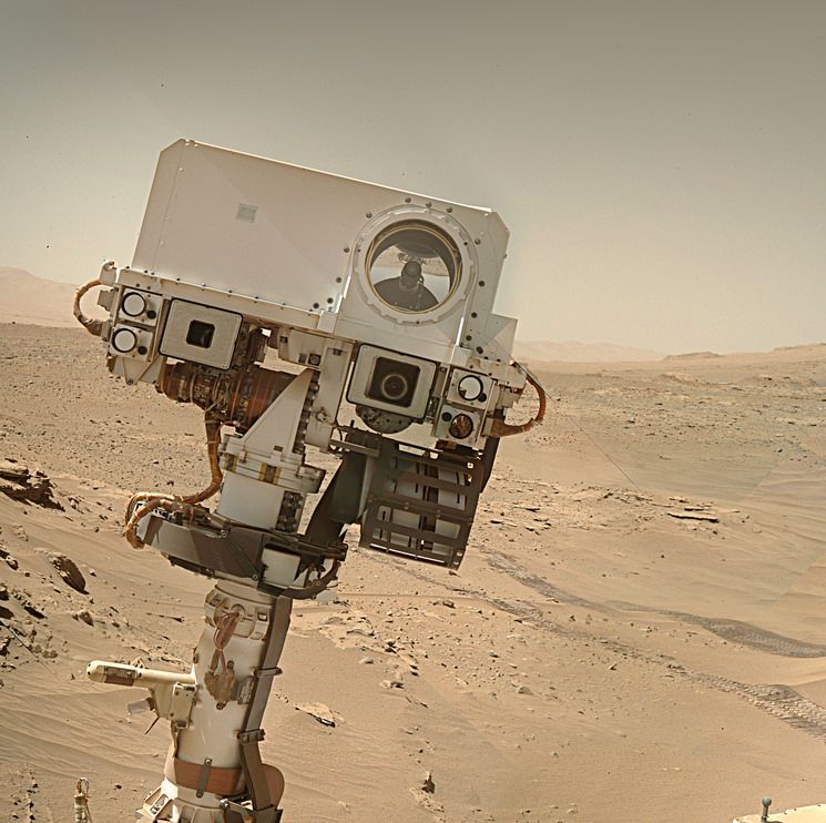
L-MastCam mosaic assembled in MS-ICE from 15 post-drive Bayer reconstructed images.
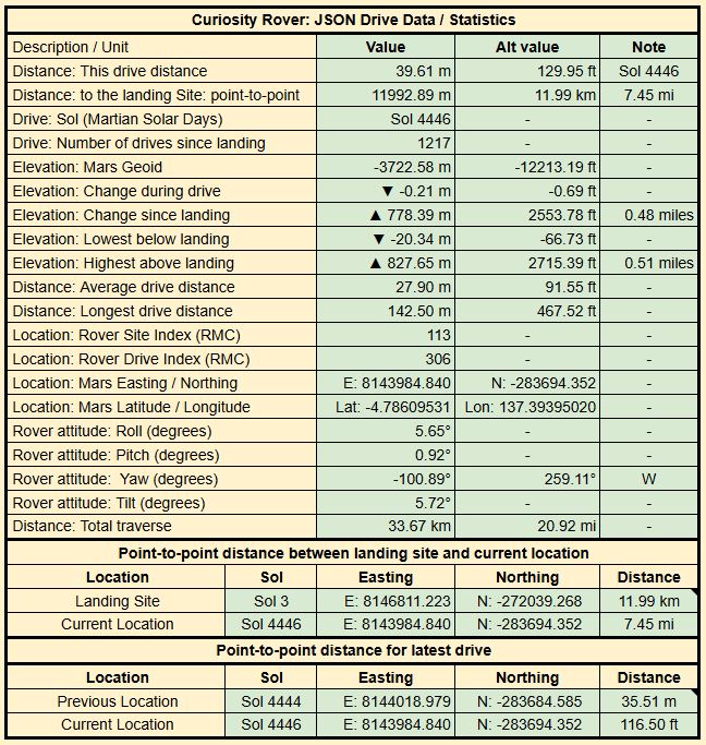
Here’s the drive data
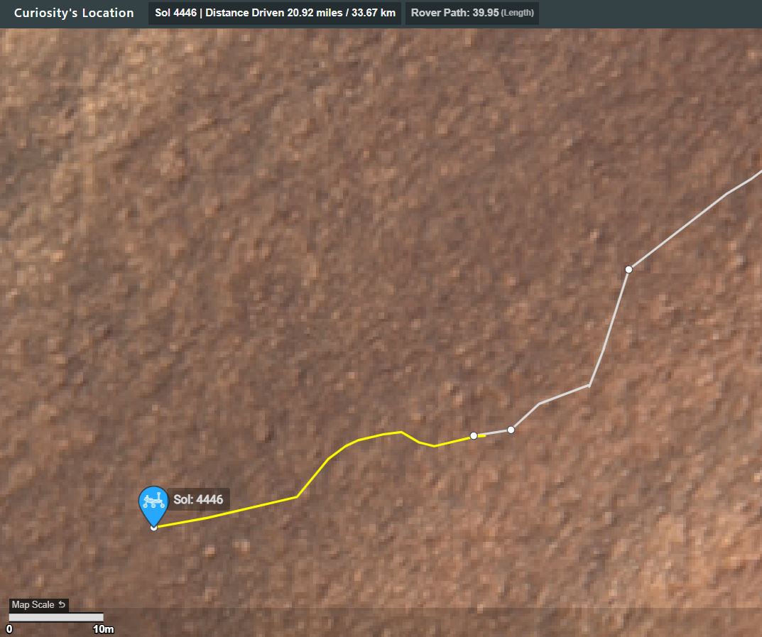
Map: The drive path is shown in yellow, there is a scale bar, North is up. Note the short drive East to free itself from the rock that stopped the previous drive short, before it drove to the West.
A wider view of the traverse (1km scale bar)