
- cross-posted to:
- [email protected]
- ebikes
- cross-posted to:
- [email protected]
- ebikes
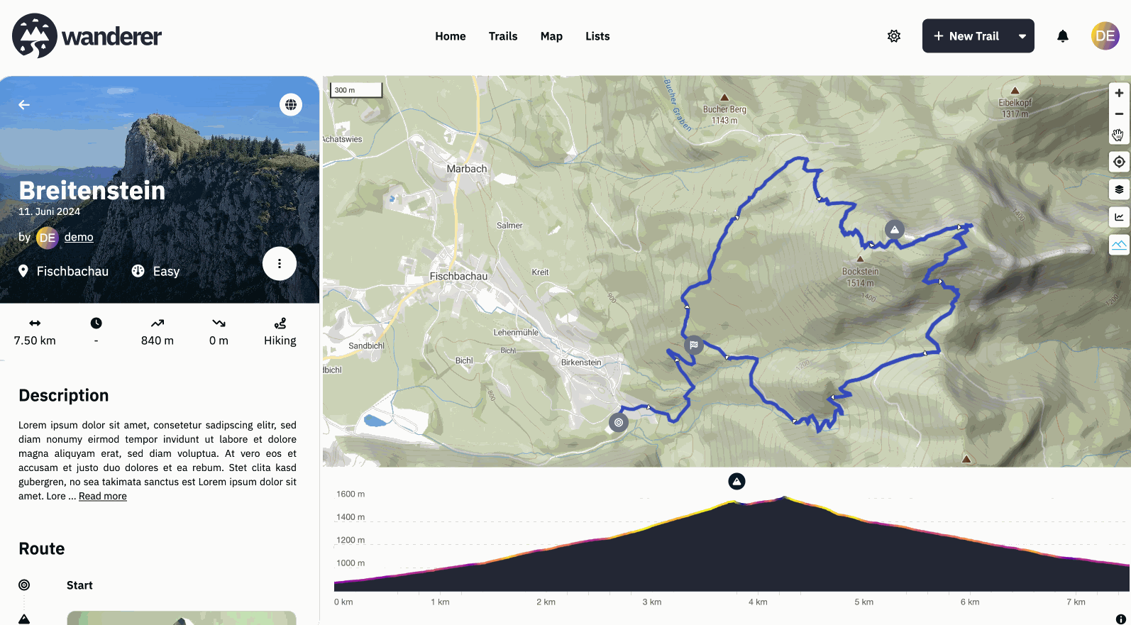
Hey everyone, #What is wanderer? wanderer is a self-hosted GPS track database. You can upload your recorded GPS tracks or create new ones and add various metadata to build an easily searchable catalogue. Think of it as a fully FOSS alternative to sites like alltrails, komoot or strava. #What is new? I’m coming back here to tell you a bit about what has been happening since my last update. Since then, we implemented some highly requested features:
- A fancy new 3D model on the front page (there is an easter egg, can you find it?)
- wanderer now uses vector map tiles which results in a significant performance boost for everything map-related
- As a result, we now also support topographical 3D maps in wanderer (see gif)
- Greatly improved social features: from list sharing, over profile pages and activity feeds to notifications
- The better location search allows you to search right down to the address
- And finally probably the most requested feature: integrations. You can now sync all your trails from strava and komoot directly with wanderer without having to manually export/import them
Big thanks to everyone who contributed code or translations! If you have any suggestions/questions feel free to let me know below.
Have a great weekend!
Flomp
- Github repo: https://github.com/Flomp/wanderer
- BuyMeACoffee: https://buymeacoffee.com/wanderertrails
- Docs: https://wanderer.to
- Demo: https://demo.wanderer.to

- There is a mountain symbol on the map. Press it to activate the terrain. Drag the compass needle to tilt the map
- Thanks, fixed,
- A public trail is visible to everyone, including non-registered users. A shared trail is only visible (or editable) for the users you share the trail with
- If you add a summit log to a trail it is considered “completed”
- Can you provide a full error stack trace, please?