
cross-posted from: https://mastodon.au/users/simongerman600/statuses/112025868592356511
(Originally published earlier today on mastodon.au)
cross-posted from: https://mastodon.au/users/simongerman600/statuses/112025868592356511
(Originally published earlier today on mastodon.au)
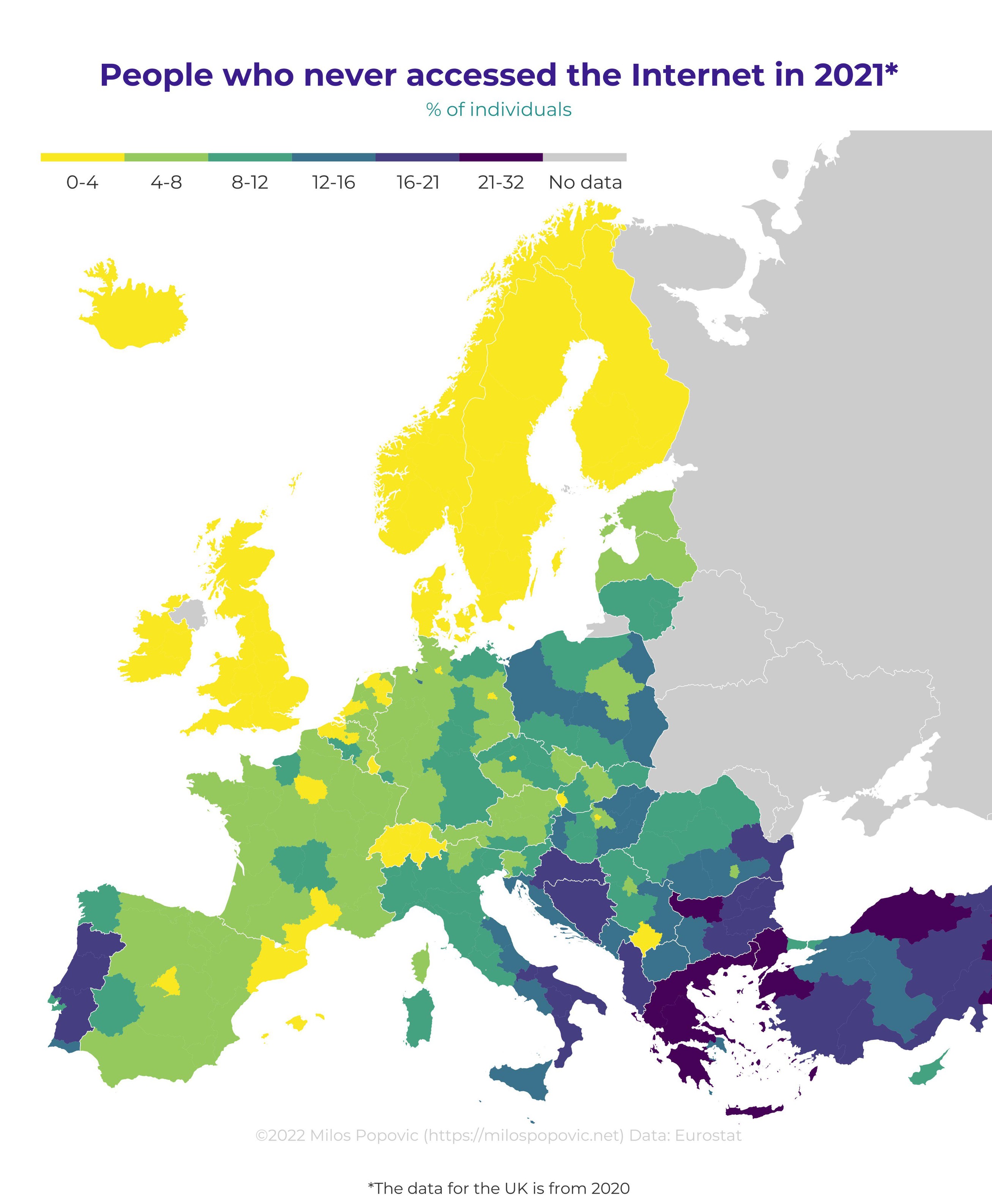
I can answer for Germany, it’s pretty much the same map as our demographic map. Eastern Germany is old, with older people not being interested in technology. Also this map seems to draw the borders on our states, so e.g. bavaria as a whole seems high, but it’s a mean vs median thing I guess.
Adding onto this, the two yellow spots are Hamburg and Berlin (which are city-states). The weirdest outlier to me is Bremen (the third city state), which is significantly worse than everywhere else (both dark spots are Bremen). No idea why though.
Poorest state in the country might be why