
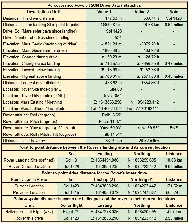
No official distance data yet, but using the xyz image metadata I get a point-to-point distance of over 165 meters. I’ll post the updated map and official drive details as soon as they are published
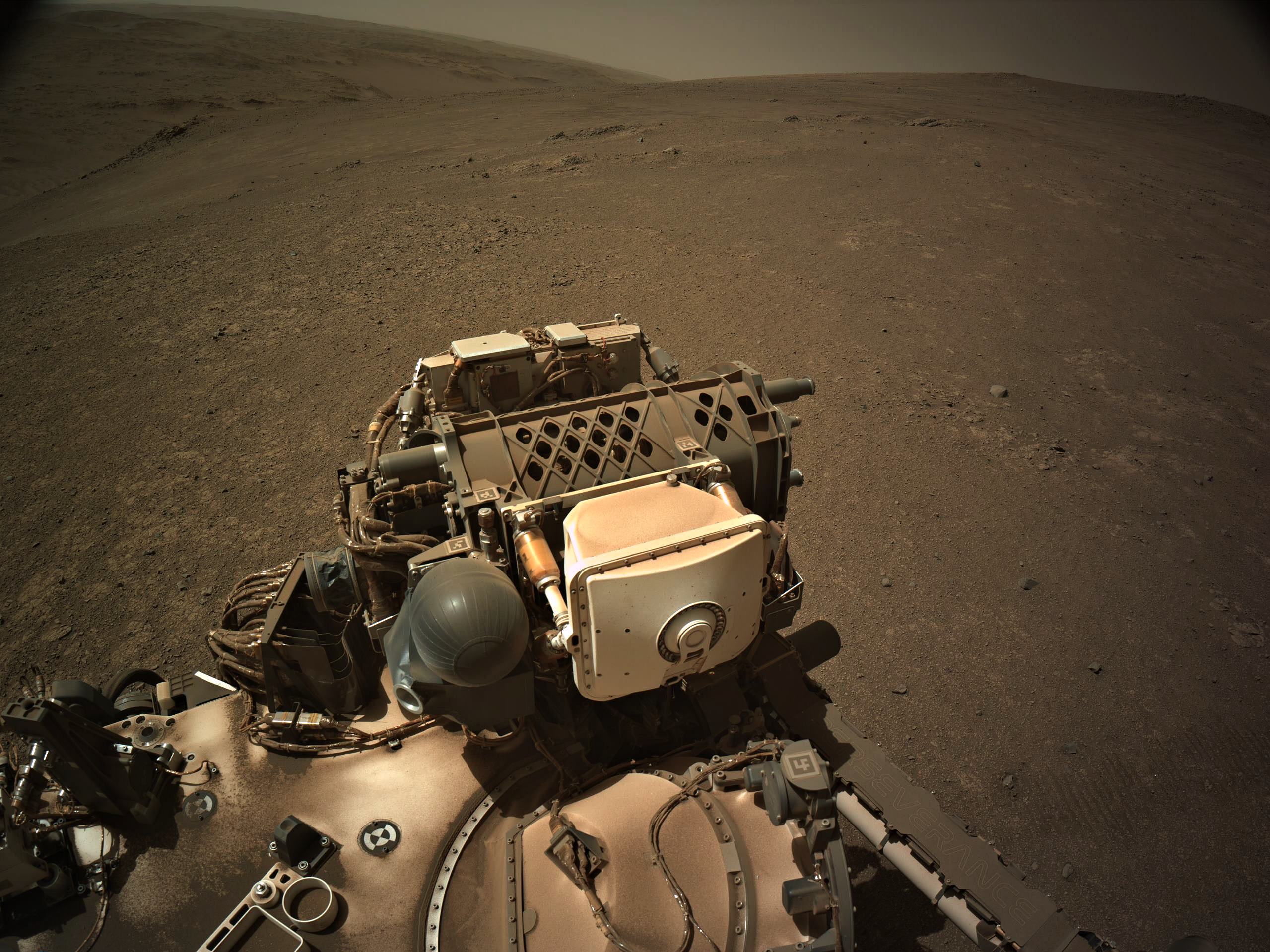
The image is a roughly processed 4-tile end-of-drive NavCam from the new location.
Image credit: NASA/JPL-Caltech
You must log in or register to comment.
Here’s the drive data, a simple table using the JPL JSON URLs that are updated after every drive
Nice selfie. Age has treated you well!
She’s aging gracefully :)
Drive was almost directly West downslope by close to 40 meters, the point-to-point is close to 169 meters, but there was a 180 degree turn in place at the end of the drive, so I estimate the total traverse will be over 170 meters.