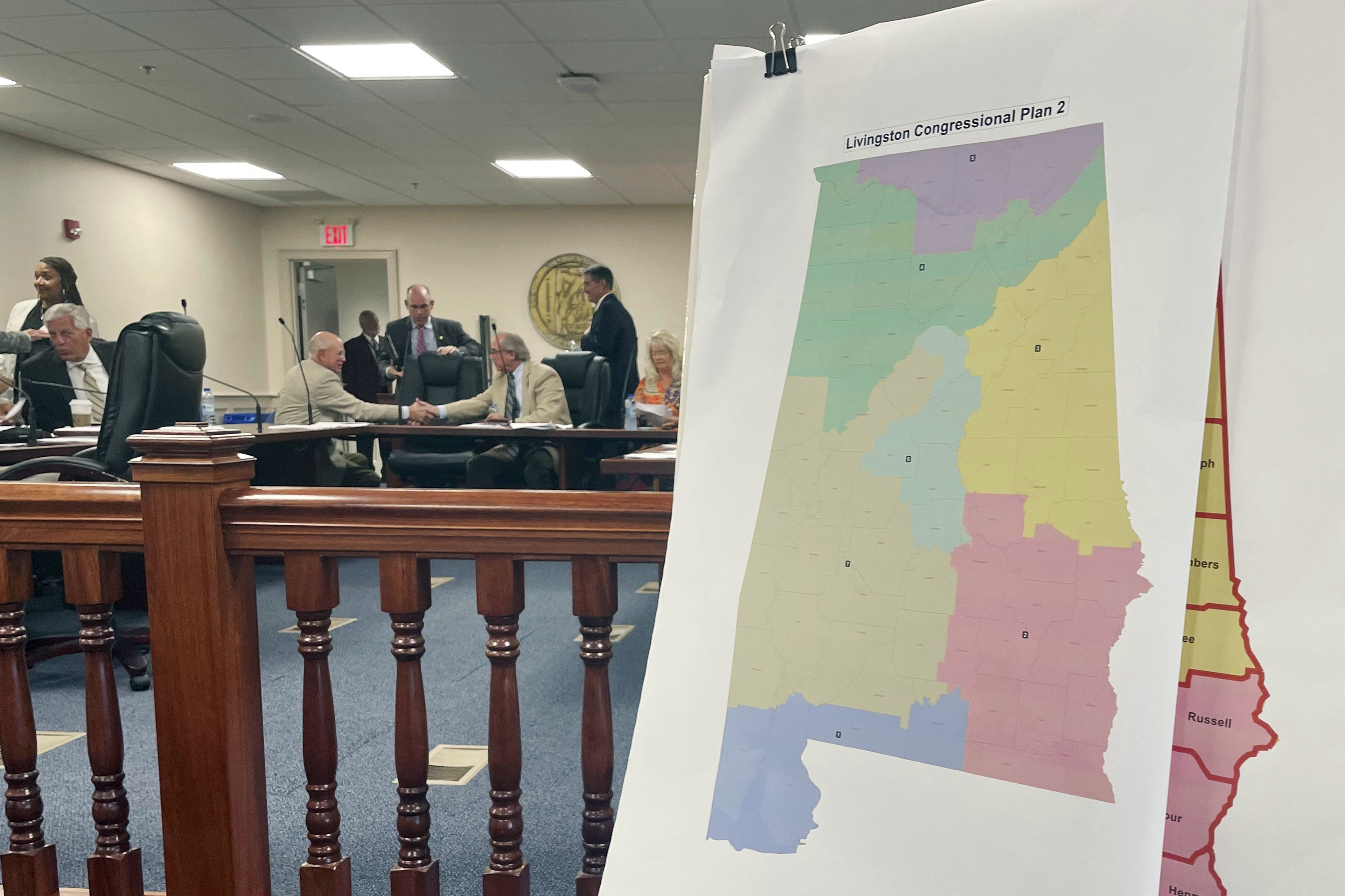
The map will likely add a Black — and Democratic — member to the delegation.
A federal court has picked Alabama’s new congressional map, which will likely result in an additional Black — and Democratic — member in the delegation.
The new map came after the same panel of federal judges twice found that lines drawn by the GOP-dominated Legislature likely violated the Voting Rights Act by weakening the power of Black voters. The new lines will be used for at least the 2024 elections, the state’s Republican secretary of state said on Thursday, though Alabama Republicans have vowed to fight them for future cycles.
The map gives greater electoral power to Black residents, who make up about one-quarter of the state’s population. And it will very likely mean Republicans lose one seat in their thin majority, imperiling their already tenuous hold on the lower chamber even before battleground districts come into play.


Imagine if all the red states where the GQP electorally assaulted the voting districts (and it was almost all of them, thanks ALEC) had to go to the goddamned supreme court to get it resolved which the arrogant GQP then flat-out refused to do! JUST to eke out a sliver of balance back to these extremely unfair maps.
See more: https://www.theguardian.com/us-news/ng-interactive/2021/nov/12/gerrymander-redistricting-map-republicans-democrats-visual
Cheaters. Crooked as sweet fuck-all, no wonder they love that orange rapist shitbag.
I mean, this literally used to be part of the Voting Rights Act, that states with a history of racist gerrymandering would have to get federal clearance on things like their election maps.
That’s what Shelby County v. Holder was about. Making it easier for states to engage in racist gerrymandering because the conservative justices like it.
They claimed the preclearance requirements were unconstitutional because they were based on old data (not a legitimate reason to find it unconstitutional) in spite of the fact that the VERY CASE THEY WERE RULING ON proved the exact relevant need for the law they were striking down.
I have always been partial to placing geometric measure restrictions on district mapping. Things like they “must contain no less than 90% of the proportion of the state population and the number of districts” and “the area between any 2 1 mile long edges of the district must be at least 4 Square miles” or “the borders of a district may contain no more than 6 corners, none of which may have angles greater than 100 degrees or less than 80 degrees.”
Make the Republicans work for it, make it a trip back to math class which we all know they failed.
Geometric rules like that can still cause communities to be unreasonably divided. The decision to avoid “funny” shapes can itself be used as a methodology of cracking and packing. There’s no rule that people spread out evenly and in sensible forms across a state, unfortunately. I remember a model from a textbook I read once where they just had the districts as even slices of a pie chart and showed that merely rotating the starting point could swing an election one way or another, given that communities are not homogeneous.
To put it another way, sometimes you NEED a funny-shaped district to AVOID disenfranchising a community because that community lives in a funny-shaped neighborhood.
The relevant video I always evangelize in the discussion: https://www.youtube.com/watch?v=Lq-Y7crQo44
The belief that there is a “fair”, nonpolitical, algorithmic, or similar objectively-correct method to district is a nice one, but it just can’t be true. Redistricting is an inevitably political process. Any way you cut it, you are picking the voters and distorting the final results.
The best compromise I am aware of, in the US system, is to have a bipartisan or nonpartisan (is there really a difference in a 2-party system?) commission overseeing distracting in an open and transparent process. And even then, all we can do is our best. The hard work of governance. It is not a problem you “solve”, it is one you have to wake up every day and commit to improve steadily.
I agree in principle with your assessment. I have a math degree and work with data and optimization, so I understand full well that ANY set of rules can be abused if you understand them well enough and know what “optimized” looks like for your ends. That said, there are definitely O() complexities to optimizing and abusing rule sets. And there is also usually some soft cap on exactly how effective an abuse can become within a rule set. I am not looking to “solve” the problem, but more of trying to lower the soft cap and raise that O from O(1) to at least O(n^2) for how complex it is to abuse the rules.
At the high level, no party should be easily able to say “I want this neighborhood full of rich white folks, but need to be sure not to included the apartment building full of poor black people that the neighborhood wraps around”. Both are part of the same community, they shop at the same stores, drive on the same roads, their kids likely go to the same schools, and they should have representation that cares about the whole community. So I fail to see how your comment about “funny shaped neighborhoods” does anything but exemplify the mentality that causes the issue in the first place. I will watch that video tonight, perhaps it will enlighten me.
What the fuck is the GQP?
Grand Qanon Party - aka Trumplicans