

TL;DR:
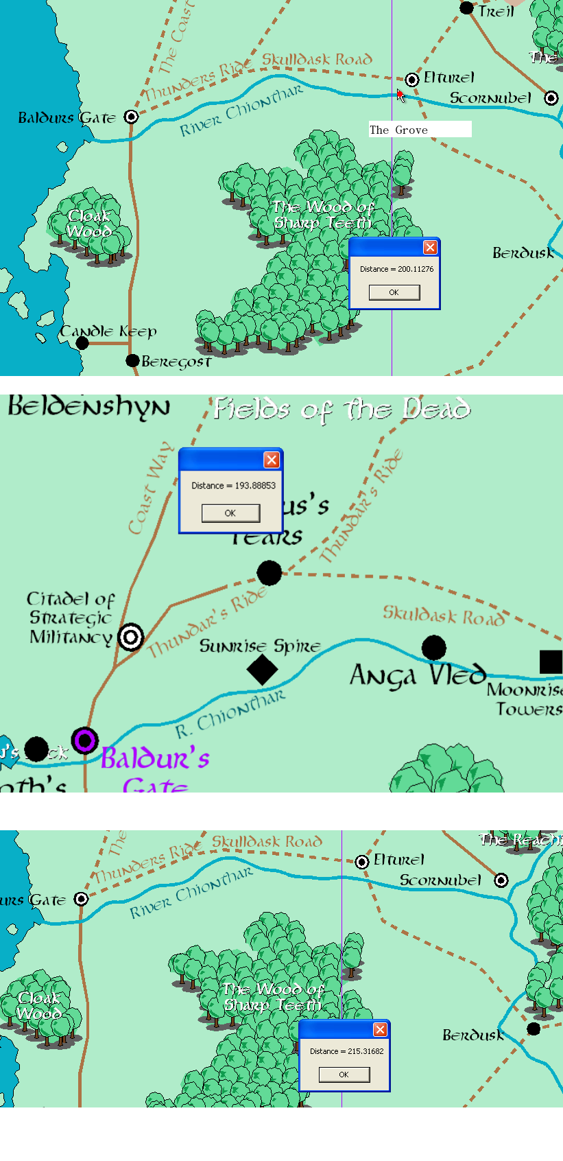
Elturel = 215 miles east of Baldur’s Gate The Grove = 200 Miles East of Baldur’s Gate Moonrise / Reithwin = 193 Miles East of Baldur’s Gate
(Migrating accounts and reposting on TTRPG as it seems more relevant here. We’re working on a more robust version of this.)
My partner and I have been trying to pinpoint the locations in Baldur’s Gate 3 on the Sword Coast map.
Larian, in their Gameplay Demo, revealed two vital bits of information. First, that the nautiloid crash site was on the Chionthar and second, that it was approximately 200 miles east of Baldur’s Gate. The Blighted Village, Goblin Camp, and everything else should be relatively close (within 5-10 miles) of The Grove. In-game text suggests that The Blighted Village, Moonhaven, is on the border of the lands controlled by Elturel, but where that border is or what it means is squishy.
Moonrise was more difficult. The only out-of-game reference to Moonrise was in an old adventure, and the only map we could find with Moonrise definitively mapped was in the old Forgotten Realms Interactive Access mapping tool. We got our hands on a copy and proceeded to measure distances. The results are available above.
Caveat: The maps of the Sword Coast have changed over time. Sometimes, TSR / Wizards changes distances dramatically, so this estimate is only that. Take this with a grain of salt / as a fun project we undertook to better understand how in-game locations meshed with Sword Coast locations.
What software are you using for the map mapping.
The Forgotten Realms Interactive Atlas. Its been discontinued for a while so eBay is prob your best bet.