

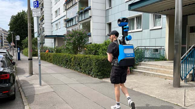
If you’re not Google (or, to a much lesser extent, Apple), map apps are damned hard to make. Last year, several major heavy hitters in tech, including the likes of Meta, Microsoft, TomTom, and Amazon, decided to lay down their arms and meet under a flag of parlay held aloft by the Linux Foundation to make mapping just a little easier, cheaper, and less dominated by two companies. Alone, none could establish a big enough data pool to rival the likes of Google Maps, but with their individual hoards of business location data, satellite mapping tech, and more support from smaller tech firms, they could perhaps gather enough data together to help create a whole new series of up-to-date map apps.
On Wednesday, this pooled initiative, called the Overture Maps Foundation, shared its first alpha release for its mapping data. It contains millions of examples for buildings, roads, and geographic boundaries. It’s only the first large release for the planned massive dataset, but the hope is there will be much more to come as companies sign on.
Marc Prioleau, the executive director of the Overture Maps Foundation, was named as head of the project back in May. He’s been around mapping projects for many years, having worked in the start of the GPS market back in 1995, and later moved on to the likes of Meta and Uber for their location-based services. He said if there’s one thing that strikes at the difficulty of building a high-quality app with exacting road and place information, it’s the ephemeral nature of public infrastructure.
“The hardest thing in mapping is knowing what’s changed in the world,” Prioleau told Gizmodo in a video chat. Essentially, map apps are some of the hardest to design simply because of the massive amount of data required to build the systems. Not only do they need to be accurate, but they need to be constantly updated when businesses close and new ones open.
The first Overture release contains about 59 million points of interest that the group claims has not yet been released as open data before. A POI could be anything—a public landmark, a specific building, or a local business. Otherwise, the data contains about 750 million building footprints alongside road data that’s mostly collated from the crowdsourced OpenStreetMap project.
So how much of the world does this alpha release truly cover? Prioleau said the POI data makes up around 60 to 70% of a worldwide dataset. In his mind, a good number to shoot for is somewhere between 80 and 100 million places. It’s something of a Goldilocks problem. With around 200 million POIs, Prioleau said you’d likely be hoarding a lot of “junk,” but too little means you’re obviously missing out on locations, especially from less represented countries.
As far as the building data, he said that “feels pretty complete” as far as laying out worldwide structures, considering that the U.S. itself contains something around 100 million buildings. A good chunk of that data came from Meta through businesses listing their addresses on Facebook or Instagram. Microsoft also handed over some of its data through its work on Bing Maps, but the two sets combined included duplicates, which cut down on total numbers. The Overture director said the foundation has plans to add more datasets in the future from other sources centered on different continents.
The road data is a different beast entirely. The vast majority of it is based on the OpenStreetMap project, an open source, wiki-style resource compiled by internet users going on nearly 18 years. Prioleau said Overture has modified the project’s info to make it easier to attach new datapoints. The project has also worked to standardize and fact check the data contained on the project’s site. There’s also several benefits to using this Wikipedia-style map compared to how Google might spend billions maintaining its map data every year (or otherwise buying up the competition like it did with Waze). Users on the ground can archive and modify the map to note damage during a natural disaster.
“One of the things [OpenStreetMap] does incredibly well is build richness into the map, because what you map is no longer determined by what your commercial interest is, it’s what the community wants to map.”
Prioleau described himself as “the only full time employee” of the Linux Foundation-based group. Otherwise, the Foundation has depended on around 130 engineers from Meta, Microsoft, and more of the steering companies. As far as maintaining the data, the Overture head said that there’s no contractual agreement for companies to use the open source resources, but they’re still heavily encouraging all those who build upon their foundation to somehow give back to the data source with any new information they collect.
“The incentive is: if you want to fork [AKA build off] Overture, start building your own dataset and not give stuff back, then you’re on your own to maintain that dataset going forward.” Prioleau said. “So the incentive to giving back is that your data remains part of this consortium.”
What’s next is to create a “global entity reference system” for attaching data points to a map, which will then facilitate even more layers of information for new apps. Today’s map users aren’t just looking for ways to get from place to place, but from door to door. Delivery drivers need to know where they can pick up and drop off items. People with disabilities want to know where they can find ramp or elevator access.
“Maps are really digitization of things that are observable,” the Overture lead said. “We’re not mapping secret stuff. We’re mapping roads and addresses and places—things that are observable. And as the ways of capturing observable stuff gets better, the ability to build maps gets better.”
Links: gizmodo.com/your-phones-navigation-app-is-probably-smarter-than-you
https://gizmodo.com/iphone-find-my-apple-maps-mistake-houston-house
gizmodo.com/linux-google-maps-meta-aws-microsoft-tomtom
prnewswire.com/news-releases/overture-maps-foundation-names-marc-prioleau-as-executive-director
gizmodo.com/why-google-buying-waze-will-keep-you-out-of-gridlock
I’m a bit confused why you wouldn’t directly contribute to OpenStreetMap. That database is already in-use by many- further splintering of open alternatives to proprietary mapping only hurts the FOSS community IMO because we need as many hands on deck as possible with OpenStreetMap making the data better and feature-rich to maintain any semblance of parity with something like Google Maps.
If you look at the members listed on Overture’s site, you can be sure that none of them want FOSS alternatives to overtake proprietary mapping software
Meta, Microsoft, … Amazon
Yeah, that’s not a group I would associate with communal altruism.
Removed by mod
@sadreality @badbrainstorm @robotdna @reverie @Overzeetop It exists because they don’t want to contribute to OSM 🤣
It feels like an embrace, extend, extinguish type thing. Taking OS maps data, adding to it for their own purposes, maybe adapting data formats, then taking it away from people. It’s a who’s who of companies that aren’t great for privacy.
Depending on the license they can’t just “take it away” tho. They just hate google hegemoney is what I’m thinking
When this was first mentioned months ago, people guessed they want to add some AI or some other bad quality or unverifiable data, and they can’t do that in osm. Maybe process POI data automatically or something like that.
They don’t want to make the data better, they just want MORE data, without oversight. Osm community doesn’t like that.
From their FAQ:
Overture is a data-centric map project, not a community of individual map editors. Therefore, Overture is intended to be complementary to OSM. We combine OSM with other sources to produce new open map data sets. Overture data will be available for use by the OpenStreetMap community under compatible open data licenses. Overture members are encouraged to contribute to OSM directly.
Yeah exactly, and osm can already handle pois and everything they’re talking about
OpenStreetMap is a more than good enough database for a Google Maps alternative, they’re just trying to discredit it at this point, all major map apps use the far more detailed OSM data in some form, including GMaps. What people have an issue with is the lack of software, though at this point Organic Maps or Magic Earth could probably be a full replacement for most
OpenStreetMap is a joy to behold and fun to edit too, but for me where it really falls behind is its route planner :/ Google Maps lets us plan with public transport, shows multiple route options with journey times, and lets us edit walking paths by just dragging the line. OSM desktop doesn’t seem to have any of these features.
OSM is just a database, not maps or routing.
OpenStreetMap.org is more of a showcase for the data, not really meant for getting the most out of it. OsmAnd for example does a ton of stuff with it. Offline routing, satellite overlays, different styles etc.
Looks nice, I wish they had a desktop app.
All of that is software, I agree that this is really missing for osm.
Where does Gmaps use OSM data? Only case I know is (IIRC) kind of accidentally through a Polish bus company whose schedule uses OSM data
We’re now looking at pulling this data into OSM. Lots of discussions around this. The license is permissive.
Please don’t, or at least be careful. There is a reason they build on top of osm and not contribute back, some of the companies behind this project are huge sponsors of osm as well.
Though the license is compatible according to the osm foundation, they updated to this 2.0 license for this reason:
As a follow up, CDLA Permissive 2.0 is compatible. It is very similar to CDLA 1.0, but 2.0 has made the attribution components easier to comply with, decreasing the complexity for a person adding data under this licence to OSM. (See LWG minutes 2022-11-10)
https://wiki.osmfoundation.org/wiki/Licence/Licence_Compatibility#Linux_Foundation_CDLA_Permissive
But! from their FAQ:
Overture is a data-centric map project, not a community of individual map editors. Therefore, Overture is intended to be complementary to OSM. We combine OSM with other sources to produce new open map data sets. Overture data will be available for use by the OpenStreetMap community under compatible open data licenses. Overture members are encouraged to contribute to OSM directly.
From this I think the quality and/or verifiability or something else doesn’t conform osm standards. I guess the building footprints are the same shitty ones you can already see with MapWithAI.
One does not simply add gigabytes of data to OSM 🤣
This will probably take lots of discussion, and involve some verification of the data. Plus, a lot of this already exists in OSM so duplicates will have to be removed.
It’s a huge resource and opportunity, but not straightforward.
I mean when I’m mapping on a small scale I look for the buisnesses on Google maps and then put it in OSM but in a better position closer to reality.
Don’t copy from google that’s illegal.
The thing what you are doing is in a grey area, and on osm it’s not recommended:
Do not forget that OpenStreetMap is not a project to explore legal grey areas of copyright and contract law, it is a global project to provide free to use, open and legally untainted geodata. Please do not endanger it by trying to take shortcuts.
https://osmfoundation.org/wiki/Licence/Licence_and_Legal_FAQ#2.1.5._Can_I_copy_data_from_Google?
Related: check the section “License issues” on this page: https://wiki.openstreetmap.org/wiki/Completeness#License_issues
The data source we are speaking about is compatible with the ODbL license, unlike Google.
lol with that kind of thinking we should stop mapping altogether if there’s a mountain I’m going to map it if it’s google as well that’s their problem I’m using satellite imagery. I’m here to help add data to open source no go over legal licenses.
@TheFrirish @infeeeee @openstreetmap
Copying from Google is prohibited contractually via their terms of service and risks dragging the projects tiny foundation into expensive lawsuits.You aren’t helping OSM by copying from Google you’re jeopardizing it.
Go Touch Grass.
You’re deliberately ignoring contributor terms you’ve agreed to and you think I’m the one who hasn’t been out in the world recently?
What? Because it’s online it’s ok somehow?
deleted by creator
There is copyright for maps as well, it’s not as straightforward as for an artwork, but there is. It’s not a new thing, mapmakers used several tricks to stop copying their maps well before the internet:
It’s tricky, because a map maker can’t copyright reality. But the data itself is copyrightable. The way it collected, displayed, formatted, structured, etc. is copyrightable. Also Google has terms and conditions and it explicitly forbids the use of StreeView and GMaps for the development of other tools. So maybe if it’s not straight illegal, G* can sue osm for your edit.
I’m here to help add data to open source no go over legal licenses.
Unfortunately laws apply to everyone and everything. OSM is not some anarchist organization, we have to respect laws, even if we don’t necessarily agree with them. That’s how the world works.
Of course if you do this occasionally you won’t get caught. But from your comment it sounded like it’s your daily workflow, and while the chance that someone reports you to DWG is minimal, you have to know that what you are doing is on a thin line.
I dare them to sue OSM because I copied some website or opening hours into a place on OSM.
I mean, sure, if you blatandly copy entire neighborhoods and very obviously map it exactly as in Gmaps, then there is a basis for a law suit. But you you just recycle bits here and there, how do they even prove that Gmaps was the source? They’d have to do that on a case-by-case basis. Good luck with that.
As much as I appreciate your effort in a constructive reply, There are way too many ways I can defend myself and google cannot sue me for observations.
I only occasionally do this but I’m so offended by your logic that I think I’m going to go out of my way to do it. I dare google to protect their copyright of Reality.
When and if I do it it’s always way more accurate in terms of positioning so not in the same position. That means that it’s not the same data.
If mapping reality that shares the same data with Google is some kind of anarchism for you then I have simply no arguments.
Google maps is more than just a map. You can submit pictures of a restaurant to gmaps. Google knows that the business still exists and other people can validate the data. On osmand you don’t even see how the restaurant looks like.
This kind of app https://github.com/Discostu36/OSM-Photos is needed for osm to succeed and become mainstream.
Imagine connecting activitypub to osm POIs. People/users would interact with the map.
I guess this was never really the goal of OSM itself - the problem is perhaps rather that almost all sites collecting pictures and customer feedback are proprietary and don’t share their data easily with third party apps.
I think it’s only a matter of time before we get federated alternatives to services like Yelp and TripAdvisor, which would then get integrated in apps using OSM.
I can’t wait - I’m often torn between wanting to leave a good review and not wanting to feed even more data into Google.
@sab @badbrainstorm @booklovero mapcomplete.osm.be ties together pictures and reviews by @mangroveReviews . Feel free to make a Mastodon-widget showing socials though!
That’s fantastic! Hadn’t heard of it before. I guess there might be valid reasons to use a separate protocol rather than activitypub as well (I haven’t given it nearly enough thought, just daydreaming).
Will check out ways to contribute reviews to Mangrove from now on! :)
@sab @badbrainstorm @booklovero @mangroveReviews Eh, Activitypub hasn’t been very popular 'till last year ;)
Furthermore, thé big problem with reviews is reputation and real reviews. Activitypub doesn’t give a big advantage for a problem like that.
Well, a bit longer in nerd circles, but still. ;)
Another issue that would need solving is probably the issues of content not federating retroactively. If there’s a network of federated review websites you might want the same reviews visible in all. Then again, maybe map apps could just scrape information from the most central node in the network.
Not obvious what the advantages would be over a separate protocol though, and no need to re-invent the wheel. :)
I could see this for like restaurants advertising, but 99% of the time I’m using the map its for directions from A to B, I already know where I’m going - just not how to get there
People don’t want two apps. So it needs to have features to cover the 100%.
This is like a year old cement, but yeah but you can’t expect to have a superapp covering every possible option too lmao
For most people Google Maps is that super app. So you can definitely have that.
Me doing my taxes in google maps
Let’s not forget reviews. One of the most important things for most people.
Why did the first line have to mention Apple? Just why? Their maps are pretty much the same OpenStreetMap data but with a few novelty features.
As a school bus driver, the guides in Apple Maps is so useful. Google insists it directs me when I create a route, but I just want to see a top down map of where my stops are with a quick tap of the stop then navigate if I do want directions.
I’m sure that’s not the intended usage, It’s way more than a novelty for me.
Why would I use something closed source as a replacement? OSM is a far better option.
That’s not an issues here the data is open to everybody indeed there is the Linux Foundation behind this, it uses the CDLA Permissive v2.0 license and people are even talking about using it for mapping on osm!
I stand corrected if they allow imports into OSM.
Because this is a mix of the directory listing of Facebook and Instagram+bing buildings+some more stuff. And it is very liberally licensed, allowing to (slowly) import all shop information from Facebook into OSM…
Basically, a big part of the data that is missing in OSM!
They include OSM data mixed with other sources.
https://overturemaps.org/download/overture-july-alpha-release-notes/
How can I contribute on a user level?
I’m also an advocate for StreetComplete (https://streetcomplete.app/). If you’re an Android user, it makes it really simple to do many kinds of OSM updates.
It’s also encouraging me to get out and walk around my neighborhoods so I can verify & collect the data for OSM.
deleted by creator
Very cool! I really enjoy seeing these different tools being built out upon the API for varying interests and needs.
This is what I use. Also, Organic Maps is a great new map app, that I use for adding most businesses. And I have to use osmand for those weird categories that don’t come up in Organic
I see, thanks
Try https://mapcomplete.osm.be and pick a thematic map within your interest.
Organic Maps is a great maps app. It also has great features to edit and add places to OSM.
Delivery drivers need to know where they can pick up and drop off items. People with disabilities want to know where they can find ramp or elevator access
the first benefit he mentioned was kind of product which they can sell (system for helping delivery drivers reach faster), helping increase accessibility was later. It shows priorities for whole project.


