
- cross-posted to:
- [email protected]
- cross-posted to:
- [email protected]
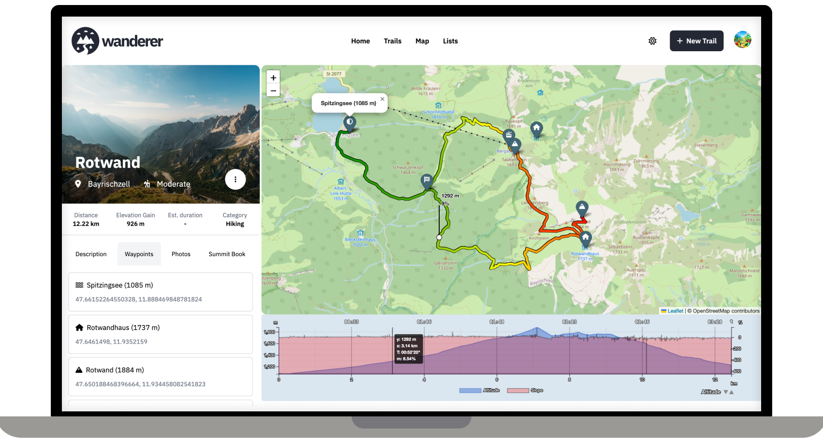
Over the last two months, I developed wanderer. It is a self-hosted alternative to sites like alltrails.com or in other words a self-hosted trail database. It started out more as a small hobby project to teach myself some new technologies but in the end, I decided to develop it into a fully-fledged application.
Core Features:
- Manage your trails
- Extensive map integration and visualization
- Share trails with other people and explore theirs
- Advanced filter and search functionality
- Create custom lists to organize your trails further
- Chique design with a dark and light theme
- Fully mobile compatible
wanderer is completely open-source. You can find the GitHub repo here: https://github.com/Flomp/wanderer
wanderer is still under active development so if you encounter any bugs/errors or have suggestions please let me know here or open an issue on GitHub.
I’m not sure if I understand your question correctly. Do you mean creating a trail from scratch on the map without recording it before? That is indeed on my roadmap.
That and sharing it with other users through the ActivityPub protocol (what Lemmy uses)
I see. I’m unfamiliar with the protocol, but sharing trails is definitely on the roadmap. So I will look into it!
Unless Pocketbase adds support for ActivityPub, you are probably better off just adding a share to Mastodon, Pixelfed etc. button in the frontend and let an external software handle this.
There are hiking trails (which are marked with signs) where you can find the gps tracks online.
At least that is the case in Germany.