

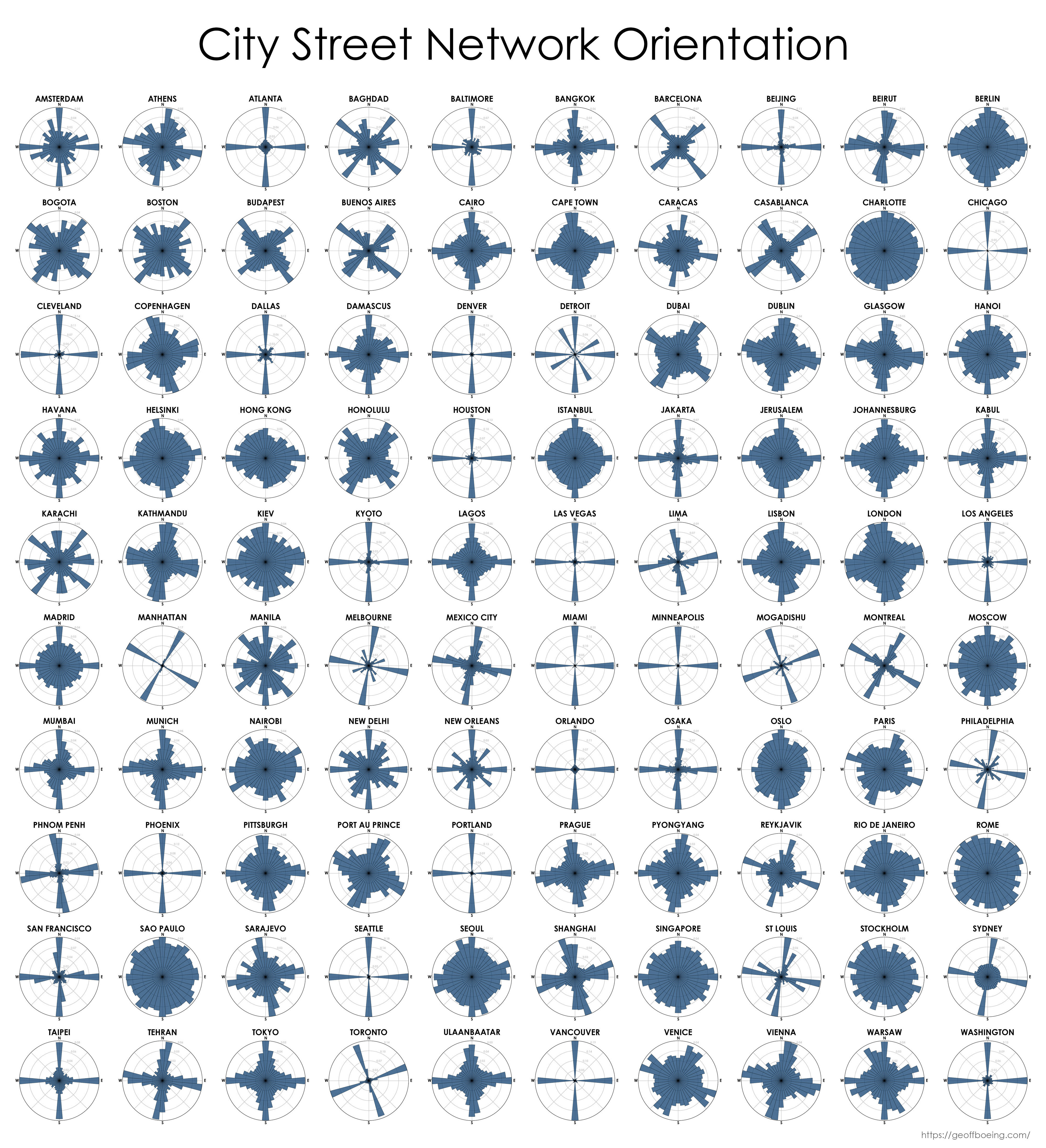
I might be a moron here, but I have no idea how to interpret this. Is each blue bar the proportion of streets that run in that direction? Do the ones that just have a single bar at N/E/S/W have perfectly aligned streets that only go in the cardinal directions?
Here’s a portion of detroit:
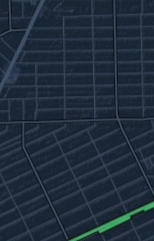
The city is almost entirely grid, some of it at an angle. You can see these two grids visualized in the post.
Seattle too has a section that’s perfectly n/s. It was built upon infill created by destroying larger hills, flattening the city and filling in the bays. The older city is canted off at a strange angle, you can see the streets change directions at denny way near downtown.
Outside the downtown corridor everything is aligned NS iirc.
That’s my interpretation too.
Newer cities tend to be more grid like. Older European cities tend not to follow a grid.
Also, how is the direction assigned? Especially for streets that are not straight? For example taking a beginning and end and measuring their angle wouldn’t be very representative. And how does it work with long and short streets? Are longer more heavily represented, or do they count the same? I’d like it if it took a tangent to the street every 100 m or so, but somehow I doubt that’s what they did.
I had presumed it’s the angles of the intersections.
So basically angles of ends of streets. Well, there are many options and we just don’t know which one it is.
This might not be the best representation if you’re trying to depict “good” cities. Madrid is famous for having a very centrally planned and carefully considered grid, and yet the graph here looks like a mess.
Fun thing is that in Montreal, ‘North’ is refereed to as the direction where streets go away from the river, which ends up being the WNW, further from north than “East”.
Heh, yeah I was gonna make people guess which one was “north” for Montreal
Tulsa, OK is a trip. Perfect square mile grids for most of the city. Looks like a chessboard flying in at night.
Until you get out to the burbs, the streets are names crossed by numbers, everything regular… I used to navigate the whole town with one page from the phone book. Even when you get into numbers crossed by numbers, it still makes sense.
I’m surprised New Orleans has any NSEW streets considering we say “towards the river” or “towards the lake” and the “West Bank” is actually east of much of the “East Bank” because of how the Mississippi turns.
I knew Boston would be a mess, but Charlotte, you okay there??
I can’t function in a city with more than 20% of the roads being outside of the majority.
Fuck Boston (lack of) city planners, and apparently I need to avoid Charlotte like the plague of disease that must’ve been occurring when they “laid out” that city.
Well I mean that’s what’s going to happen when you have a city that’s laid out by a civilization who’s most advanced transportation technology is wagon.
deleted by creator
Is that your guess, or is there a specific source that says that?
deleted by creator
Charlotte laughs at that.
Probably wouldn’t be so bad if they actually built the fucking light rail.
you take your half-built light rail that exists to ferry people into Tepper’s stadium and you’ll like it!
deleted by creator
She’s stuck in irregularly shaped traffic.
deleted by creator
São Paulo city is a messy case. It started out roughly circular, then that circle was distorted into a grid plan, then that grid plan was tied to a bunch of mismatching grids. Picture related:

As such it’s hard to reach any conclusion taking its general layout into account.
deleted by creator
deleted by creator
The part that really pisses me off in America at least, is that once you get outside the nice ordered grids of the city, you start getting into subdivisions. They start having all of these curved nonsense roads instead of again, nice straight grid lines. I understand that sometimes you have to divert around a natural feature, but that doesn’t excuse them deliberately making neighborhoods all twisty and grounded off so that it’s easy to get lost in there. Stick to the grid system. And if any European complains about it, remind them that [insert rival European country] is better than their own country.
Which direction do your streets point on a compass?
Sao Paulo: yes.
That is really insightful
Are these taken from city center? I feel like San Francisco has much more north to south road than East to West.
Berlin’s network shape is unfortunately reminiscent of a swastika…
I guess you see what you want to see.
It’s pretty obvious, it’s too bad the downvoters deny their own lying eyes.


