

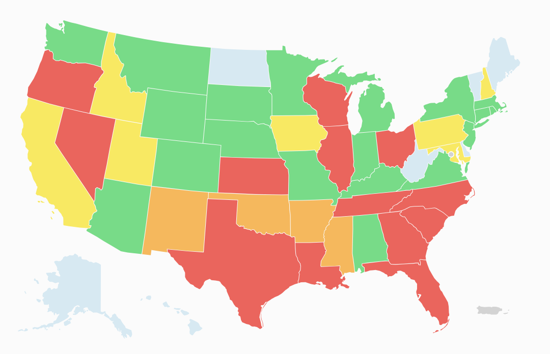
Every 10 years, U.S. states redraw their congressional and state legislative maps to account for changes in population. In many states, the politicians who control this process draw district lines in a way that maximizes their party’s partisan advantage and makes it effectively impossible for their opponents to win power.
This practice is called gerrymandering and here is a map to know more about it.
Ah the southeast…but look at you Alabama, pretty impressed. And damn Virginia, way to go!
alabama: “i didn’t do it”
(they didn’t, they wanted to gerrymander even harder. long legal battle that bounced to scotus twice ended with a federal judicial panel choosing their congressional map)
So they aren’t as slick as NC. Got it.
Alaska, Delaware, Vermont, Wyoming, and the Dakotas be like: what’s gerrymandering.
The news source of this post could not be identified. Please check the source yourself. Media Bias Fact Check | bot support